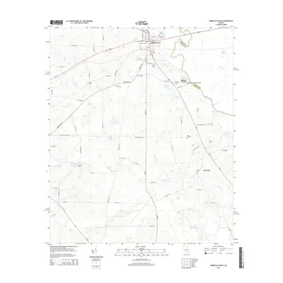
2014 Map of Abbeville South
USGS Topo · Published 2014About this map
Abbeville serves as the focal point of this South Georgia landscape, situated at the junction of Ga-30 and Us-129 just west of the Ocmulgee River. The area's agricultural and rural heritage is evident in the high density of family and community burial grounds, such as Stubbs Cem, Bowell Cem, and Reid Hill Cem. The river corridor to the east, which marks the boundary between Wilcox and Dodge counties, features Statham Shoals and a public Boat Ramp, reflecting the river's historical role in local transport and recreation. Moving south from the town center, the terrain is defined by a network of creeks and named ponds, including Cannon Lake, Fulmer Lake, and the winding Clements Cr. Small settlements like Browning and landmarks like Antioch Ch dot the countryside, connected by established routes like Sibbie Rd and Irwinville Rd.
Find a feature on this map
98 named features on this map. Tap any name to fly to it.
Don’t see what you’re looking for? This feature index may not catch every label — zoom into the map to look around manually.
Map Details
Editions of this 2014 Abbeville South Map
This is the sole edition of this map. No revisions or reprints were ever made.
Other maps of this area

1953 · Waycross
USGS Topo · 1:250,000

1957 · Macon
USGS Topo · 1:250,000

1958 · Macon
USGS Topo · 1:250,000

1958 · Waycross
USGS Topo · 1:250,000

1964 · Macon
USGS Topo · 1:250,000

1972 · Abbeville North
USGS Topo · 1:24,000

1972 · Pineview East
USGS Topo · 1:24,000

1972 · Lake Cypress
USGS Topo · 1:24,000

1972 · Queensland
USGS Topo · 1:24,000

1974 · Rebecca
USGS Topo · 1:24,000