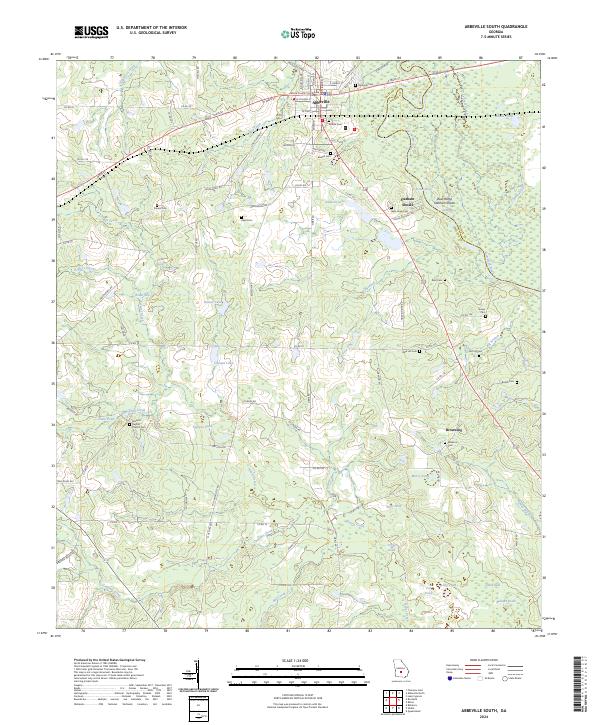
2024 Map of Abbeville South
USGS Topo · Published 2024About this map
The Wilcox County Courthouse stands as the central landmark of Abbeville, the seat of a landscape defined by the winding Ocmulgee River and its varied water features. To the south, the terrain descends into a network of wetlands and seasonal water bodies such as Gator Slide, Buzzard Roost, and Slate Hole. This 2024 survey captures the rural character of the region, where family history is etched into the land through numerous small burial grounds including Reid Hill Cem, Siloam Cem, and Keen Cem.
Find a feature on this map
106 named features on this map. Tap any name to fly to it.
Don’t see what you’re looking for? This feature index may not catch every label — zoom into the map to look around manually.
Map Details
Editions of this 2024 Abbeville South Map
This is the sole edition of this map. No revisions or reprints were ever made.
Other maps of this area

1953 · Waycross
USGS Topo · 1:250,000

1957 · Macon
USGS Topo · 1:250,000

1958 · Macon
USGS Topo · 1:250,000

1958 · Waycross
USGS Topo · 1:250,000

1964 · Macon
USGS Topo · 1:250,000

1972 · Abbeville North
USGS Topo · 1:24,000

1972 · Pineview East
USGS Topo · 1:24,000

1972 · Lake Cypress
USGS Topo · 1:24,000

1972 · Queensland
USGS Topo · 1:24,000

1974 · Rebecca
USGS Topo · 1:24,000