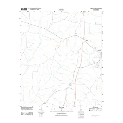
2011 Map of Abbeville West
USGS Topo · Published 2011About this map
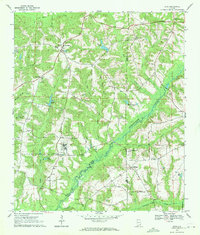
Abbeville and the nearby settlement of Graball anchor this 2011 survey of eastern Alabama, where the landscape is defined by the headwaters and tributaries of the East Fork Choctawhatchee River. The topography is marked by a complex network of creeks and branches, including Poor Creek, Skippers Creek, and Watson Creek, which carve through the terrain between local landmarks like the Abbeville Lookout Tower. Local history and genealogy are anchored by sites such as Danzey Cemetery and Roeville Cemetery, while the modern infrastructure is represented by the Henry County Hospital Airport and the major transit corridor of Great Southern Way. Smaller water bodies like Jennys Lake and Griggs Pond provide localized points of interest among the many county roads that crisscross the rural stretches of Henry County, revealing a persistent pattern of southern agricultural and woodland settlement.
Find a feature on this map
51 named features on this map. Tap any name to fly to it.
Don’t see what you’re looking for? This feature index may not catch every label — zoom into the map to look around manually.
Map Details
Editions of this 2011 Abbeville West Map
This is the sole edition of this map. No revisions or reprints were ever made.
Other maps of this area

1953 · Dothan
USGS Topo · 1:250,000

1954 · Dothan
USGS Topo · 1:250,000

1955 · Dothan
USGS Topo · 1:250,000

1969 · Abbeville West
USGS Topo · 1:24,000

1969 · Fort Gaines NW
USGS Topo · 1:24,000
1969 · Texasville
USGS Topo · 1:24,000
1969 · Clopton
USGS Topo · 1:24,000
1969 · Lawrenceville
USGS Topo · 1:24,000

1969 · Abbeville East
USGS Topo · 1:24,000
1969 · Echo
USGS Topo · 1:24,000