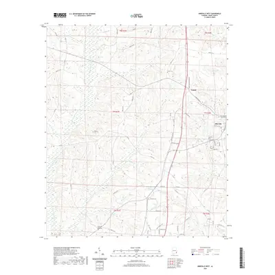
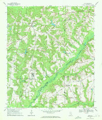
2020 Map of Abbeville West
USGS Topo · Published 2020About this map
The E Fork Choctawhatchee River defines the western reaches of this landscape, carving a winding path through Henry County. On the eastern edge, the town of Abbeville serves as a focal point, anchored by the Henry County Courthouse. The map reveals a transition from the municipal center of Abbeville and the settlement at Graball to a more dispersed rural network characterized by family cemeteries and small creek systems. Local history is etched into the land via the Danzey Cem and Pleasant Grove Cem, while the Fellowship Baptist Church Cem sits near the southern boundary. The presence of the Great Southern Boundary line bisecting the terrain provides a window into historical surveying and property divisions. Water features like Jennys Lake, Griggs Pond, and several named branches like Ginhouse Br and Keyton Br drain the territory toward the river valley.
Find a feature on this map
78 named features on this map. Tap any name to fly to it.
Don’t see what you’re looking for? This feature index may not catch every label — zoom into the map to look around manually.
Map Details
Editions of this 2020 Abbeville West Map
This is the sole edition of this map. No revisions or reprints were ever made.
Other maps of this area

1953 · Dothan
USGS Topo · 1:250,000

1954 · Dothan
USGS Topo · 1:250,000

1955 · Dothan
USGS Topo · 1:250,000

1969 · Abbeville West
USGS Topo · 1:24,000

1969 · Fort Gaines NW
USGS Topo · 1:24,000
1969 · Texasville
USGS Topo · 1:24,000
1969 · Clopton
USGS Topo · 1:24,000
1969 · Lawrenceville
USGS Topo · 1:24,000

1969 · Abbeville East
USGS Topo · 1:24,000
1969 · Echo
USGS Topo · 1:24,000