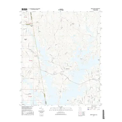
2017 Map of Abbottsford
USGS Topo · Published 2017About this map
The waters of West Point Lake dominate this 2017 landscape, straddling the state line where Troup Co, Georgia, meets Chambers Co, Alabama. This modern topographic record captures the area's transition from a river-and-mill economy to a recreational and residential one, as the flooding of the Chattahoochee River basin created complex shorelines around former high ground. Genealogists will find a wealth of burial sites preserved in the record, including the Garrett Family Cem, Whatley Cem, and Harmony Cem.
Find a feature on this map
113 named features on this map. Tap any name to fly to it.
Don’t see what you’re looking for? This feature index may not catch every label — zoom into the map to look around manually.
Map Details
Editions of this 2017 Abbottsford Map
This is the sole edition of this map. No revisions or reprints were ever made.
Other maps of this area

1899 · Wedowee
USGS Topo · 1:125,000

1902 · Wedowee
USGS Topo · 1:125,000

1907 · Opelika
USGS Topo · 1:125,000

1909 · Opelika
USGS Topo · 1:125,000

1953 · Atlanta
USGS Topo · 1:250,000

1955 · Phenix City
USGS Topo · 1:250,000

1957 · Phenix City
USGS Topo · 1:250,000

1957 · Atlanta
USGS Topo · 1:250,000

1958 · Phenix City
USGS Topo · 1:250,000

1958 · Atlanta
USGS Topo · 1:250,000