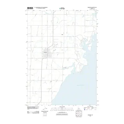
2010 Map of Aberdeen
USGS Topo · Published 2010About this map
Aberdeen serves as the primary hub for this agricultural landscape, situated on the western edge of the expansive American Falls Reservoir. The map reveals a sophisticated irrigation network essential for high-desert farming, dominated by the Highline Canal and Low Line Canal. This system branches into numerous controlled waterways, such as Lateral J, Lateral I, and the various V-series laterals, which feed a precise grid of rural roads like S 2750 W and W 1600 S. The settlement of Fingal sits to the northeast of the main town, marking a smaller node in this highly engineered environment. Near the shoreline, the terrain transitions at Little Hole Draw, where the desert's natural drainage meets the artificial waterline of the reservoir. Researchers will find a snapshot of early 21st-century water management and rural Idaho land division where the Snake River’s influence is felt through every canal and lateral line.
Find a feature on this map
32 named features on this map. Tap any name to fly to it.
Don’t see what you’re looking for? This feature index may not catch every label — zoom into the map to look around manually.
Map Details
Editions of this 2010 Aberdeen Map
This is the sole edition of this map. No revisions or reprints were ever made.
Other maps of this area

1934 · American Falls
USGS Topo · 1:62,500

1934 · Michaud
USGS Topo · 1:62,500

1936 · American Falls
USGS Topo · 1:62,500

1937 · Michaud
USGS Topo · 1:62,500

1954 · Pocatello
USGS Topo · 1:250,000

1955 · Springfield
USGS Topo · 1:24,000

1955 · Idaho Falls
USGS Topo · 1:250,000

1958 · Idaho Falls
USGS Topo · 1:250,000

1958 · Pocatello
USGS Topo · 1:250,000
1971 · Schiller
USGS Topo · 1:24,000