2024 Map of Aberdeen
USGS Topo · Published 2024About this map
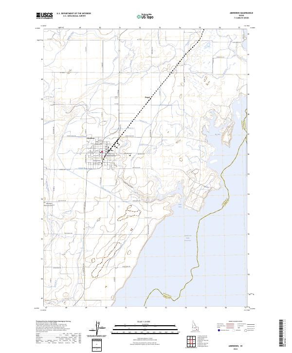
The agricultural community of Aberdeen serves as the focal point of this Eastern Idaho landscape, defined by an intricate network of irrigation infrastructure and its proximity to the American Falls Reservoir. The town's grid is clearly delineated, featuring streets like W Bingham St and S Main St, while the local Aberdeen Cem and Aberdeen Municipal Airport sit on the periphery. This map illustrates the vital role of water management in the Snake River Plain, showing a complex system of canals and laterals, including the Highline Canal and the Low Line Canal, which transform the arid terrain into productive farmland.
Find a feature on this map
68 named features on this map. Tap any name to fly to it.
Don’t see what you’re looking for? This feature index may not catch every label — zoom into the map to look around manually.
Map Details
Editions of this 2024 Aberdeen Map
This is the sole edition of this map. No revisions or reprints were ever made.