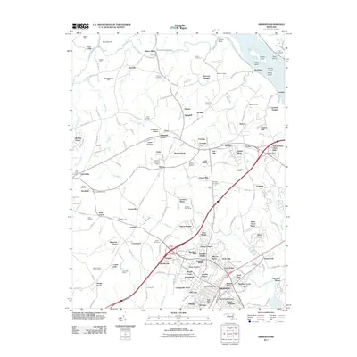
2011 Map of Aberdeen
USGS Topo · Published 2011About this map
Deer Creek winds through the northern reaches of this Harford County landscape, passing the historical sites of Wilson Mill and Noble Mill as it approaches the Susquehanna River. The map highlights a transition from established rural settlements like Glenville and Level to the more densely organized residential developments surrounding the Aberdeen city center. The riverfront area near Lapidum reveals a cluster of islands including Snake Island and Spencer Island, while the industrial legacy of the region is evident at the Port Deposit Quarry and Gray's Run Quarry.
Find a feature on this map
205 named features on this map. Tap any name to fly to it.
Don’t see what you’re looking for? This feature index may not catch every label — zoom into the map to look around manually.
Map Details
Editions of this 2011 Aberdeen Map
This is the sole edition of this map. No revisions or reprints were ever made.
Other maps of this area

1893 · Gunpowder
USGS Topo · 1:62,500

1898 · Tolchester
USGS Topo · 1:125,000

1900 · Havre De Grace
USGS Topo · 1:62,500

1900 · Betterton
USGS Topo · 1:62,500

1901 · Belair
USGS Topo · 1:62,500

1901 · Gunpowder
USGS Topo · 1:62,500

1903 · Tolchester
USGS Topo · 1:125,000

1908 · Tolchester
USGS Topo · 1:125,000

1941 · Gunpowder
USGS Topo · 1:62,500

1942 · Havre De Grace
USGS Topo · 1:62,500