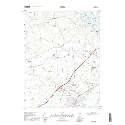
2019 Map of Aberdeen
USGS Topo · Published 2019About this map
The Susquehanna River defines the eastern edge of this landscape, carving a path past Robert Island and Spencer Island toward the Chesapeake. The commercial hub of Aberdeen dominates the southern portion of the sheet, showing a dense network of modern transportation corridors that contrast with the more dispersed settlements of Level, Aldino, and Garland to the north. These interior reaches are marked by numerous family burial grounds and community landmarks, including the Stump Family Cem and the Deer Creek Harmony Presbyterian Church Cem. Historically significant milling sites like Wilson Mill and Noble Mill sit along Deer Creek, reflecting the water-powered industrial heritage of Harford County. The map also traces the transition from the riverfront heights of Havre De Grace to the upland aviation facility at Harford County Airport.
Find a feature on this map
191 named features on this map. Tap any name to fly to it.
Don’t see what you’re looking for? This feature index may not catch every label — zoom into the map to look around manually.
Map Details
Editions of this 2019 Aberdeen Map
This is the sole edition of this map. No revisions or reprints were ever made.
Other maps of this area

1893 · Gunpowder
USGS Topo · 1:62,500

1898 · Tolchester
USGS Topo · 1:125,000

1900 · Havre De Grace
USGS Topo · 1:62,500

1900 · Betterton
USGS Topo · 1:62,500

1901 · Belair
USGS Topo · 1:62,500

1901 · Gunpowder
USGS Topo · 1:62,500

1903 · Tolchester
USGS Topo · 1:125,000

1908 · Tolchester
USGS Topo · 1:125,000

1941 · Gunpowder
USGS Topo · 1:62,500

1942 · Havre De Grace
USGS Topo · 1:62,500