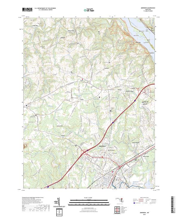
2023 Map of Aberdeen
USGS Topo · Published 2023About this map
Aberdeen and the surrounding Harford County landscape are defined by the convergence of major transit corridors and the historic waterpower of the Susquehanna River valley. This 2023 survey illustrates the dense suburban character of Havre de Grace and Webster Village alongside the more rural, rolling hills of Level and Aldino. The region's agricultural and industrial roots are visible in place names like Noble Mill and Wilson Mill, while its community history is preserved in numerous family and congregational burial grounds, such as the Stump Family Cem and the Deer Creek Harmony Presbyterian Church Cem. The map captures the significant riverine geography near Port Deposit, including Robert Island and Steel Island, highlighting the transition from the high grounds of Schoolhouse Hill to the tidal reaches of Swan Creek.
Find a feature on this map
105 named features on this map. Tap any name to fly to it.
Don’t see what you’re looking for? This feature index may not catch every label — zoom into the map to look around manually.
Map Details
Editions of this 2023 Aberdeen Map
This is the sole edition of this map. No revisions or reprints were ever made.
Other maps of this area

1893 · Gunpowder
USGS Topo · 1:62,500

1898 · Tolchester
USGS Topo · 1:125,000

1900 · Havre De Grace
USGS Topo · 1:62,500

1900 · Betterton
USGS Topo · 1:62,500

1901 · Belair
USGS Topo · 1:62,500

1901 · Gunpowder
USGS Topo · 1:62,500

1903 · Tolchester
USGS Topo · 1:125,000

1908 · Tolchester
USGS Topo · 1:125,000

1941 · Gunpowder
USGS Topo · 1:62,500

1942 · Havre De Grace
USGS Topo · 1:62,500