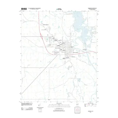
2012 Map of Aberdeen
USGS Topo · Published 2012About this map
Aberdeen and the Tombigbee River corridor are the focal points of this 2012 survey, illustrating the modern layout of this Monroe County hub. The landscape is characterized by a dense network of residential developments, from the Harmon Subdivision near the town center to the outlying Murphree Subdivision near Stinson Field Municipal Airport. The eastern boundary is defined by the significant hydrological features of Aberdeen Lake and the Weaver Creek Cutoff, indicating the importance of the river system to the area's geography. To the south, the map details smaller clusters like Binford and Evergreen, connected by a web of local roads such as Peacock Rd and Darracott Rd. The inclusion of named landmarks like Tucker Place and Oak Lawn Park provides specific points of interest for those tracking local property developments and municipal evolution in the early 21st century.
Find a feature on this map
99 named features on this map. Tap any name to fly to it.
Don’t see what you’re looking for? This feature index may not catch every label — zoom into the map to look around manually.
Map Details
Editions of this 2012 Aberdeen Map
This is the sole edition of this map. No revisions or reprints were ever made.
Other maps of this area

1953 · West Point
USGS Topo · 1:250,000

1958 · West Point
USGS Topo · 1:250,000

1959 · West Point
USGS Topo · 1:62,500

1960 · Caledonia
USGS Topo · 1:62,500

1963 · West Point
USGS Topo · 1:250,000

1965 · Egypt
USGS Topo · 1:24,000

1966 · Aberdeen
USGS Topo · 1:24,000

1966 · Amory
USGS Topo · 1:24,000

1966 · Amory SW
USGS Topo · 1:24,000

1966 · Wren
USGS Topo · 1:24,000