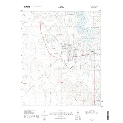
2018 Map of Aberdeen
USGS Topo · Published 2018About this map
The Tombigbee River snakes through the eastern side of this Monroe County landscape, defining the geographic orientation of Aberdeen and its neighbor, East Aberdeen. This 2018 survey documents the city's established grid, centered on major thoroughfares like W Commerce St and N Franklin St. The surrounding terrain is heavily influenced by the river's hydrology, featuring numerous oxbows, secondary channels, and cutoffs such as the Weaver Cr Cutoff. To the north and west, the land transitions into a series of creek drainages including Mattubby Creek and Hogskettle Cr. Residential pockets and recreation areas like Oak Lawn Park and Treas Lake provide a localized view of the community's layout. Further south, the settlement of Binford sits near the junction of Spring Cr, showing the distribution of smaller outposts across the prairie and bottomland.
Find a feature on this map
93 named features on this map. Tap any name to fly to it.
Don’t see what you’re looking for? This feature index may not catch every label — zoom into the map to look around manually.
Map Details
Editions of this 2018 Aberdeen Map
This is the sole edition of this map. No revisions or reprints were ever made.
Other maps of this area

1953 · West Point
USGS Topo · 1:250,000

1958 · West Point
USGS Topo · 1:250,000

1959 · West Point
USGS Topo · 1:62,500

1960 · Caledonia
USGS Topo · 1:62,500

1963 · West Point
USGS Topo · 1:250,000

1965 · Egypt
USGS Topo · 1:24,000

1966 · Aberdeen
USGS Topo · 1:24,000

1966 · Amory
USGS Topo · 1:24,000

1966 · Amory SW
USGS Topo · 1:24,000

1966 · Wren
USGS Topo · 1:24,000