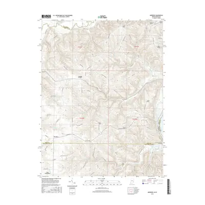
2016 Map of Aberdeen
USGS Topo · Published 2016About this map
Laughery Creek and Arnold Cr define the dissected plateau of the Ohio River valley in this 2016 survey of the Indiana-Kentucky borderlands. This region of Ohio and Switzerland counties is characterized by a series of prominent high points, including Salem Ridge, Dutch Ridge, and Carmel Ridge, which separate the various hollows and drainage basins. Small settlements such as Cofield Corner, Aberdeen, and East Enterprise serve as local hubs for the rural road network. Genealogists may find interest in the documented locations of the Bovard Cem and Grant Brothers Cem, reflecting the area's long-standing family farmstead heritage. The map captures the complex topography of the river bluffs just north of the Ohio River, where numerous seasonal streams like Wolfpen Cr and Mud Lick Cr have carved deep incisions into the landscape.
Find a feature on this map
91 named features on this map. Tap any name to fly to it.
Don’t see what you’re looking for? This feature index may not catch every label — zoom into the map to look around manually.
Map Details
Editions of this 2016 Aberdeen Map
This is the sole edition of this map. No revisions or reprints were ever made.
Other maps of this area

1915 · Lawrenceburg
USGS Topo · 1:48,000

1928 · Lawrenceburg
USGS Topo · 1:62,500

1932 · Lawrenceburg
USGS Topo · 1:62,500

1943 · Florence
USGS Topo · 1:24,000

1943 · Aberdeen
USGS Topo · 1:24,000

1943 · Aurora
USGS Topo · 1:24,000

1943 · Vevay North
USGS Topo · 1:24,000

1943 · Rising Sun
USGS Topo · 1:24,000

1943 · Lawrenceburg
USGS Topo · 1:24,000

1943 · Patriot
USGS Topo · 1:24,000