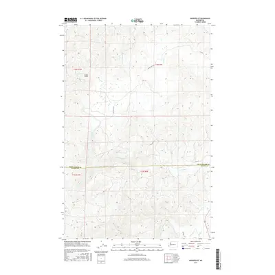
2017 Map of Aberdeen SE
USGS Topo · Published 2017About this map
The North River defines the drainage of this coastal timberland, winding through the boundary between Grays Harbor Co and Pacific Co. This 2017 survey details a landscape primarily shaped by the N River Divide and its numerous tributaries. The hydrology is particularly intricate here, with the E Fork North River joining the main stem amidst a network of smaller streams like Lower Salmon Cr and Big Cr. Navigation through this dense terrain is facilitated by a sparse road network, including the notably named American Mill Rd and Lund Rd. The map illustrates the contemporary management of these forest lands, where the natural water systems of Smith Cr and Eagle Cr remain the dominant geographic features across the township lines.
Find a feature on this map
21 named features on this map. Tap any name to fly to it.
Don’t see what you’re looking for? This feature index may not catch every label — zoom into the map to look around manually.
Map Details
Editions of this 2017 Aberdeen SE Map
This is the sole edition of this map. No revisions or reprints were ever made.
Other maps of this area

1938 · South Bend
USGS Topo · 1:62,500

1940 · Montesano
USGS Topo · 1:62,500

1940 · South Bend
USGS Topo · 1:62,500

1953 · Hoquiam
USGS Topo · 1:250,000

1955 · Montesano
USGS Topo · 1:62,500

1955 · Raymond
USGS Topo · 1:62,500

1955 · Aberdeen SE
USGS Topo · 1:24,000

1956 · Western
USGS Topo · 1:24,000

1957 · Hoquiam
USGS Topo · 1:250,000
1957 · Bay Center
USGS Topo · 1:24,000