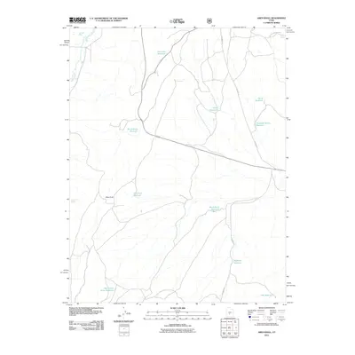
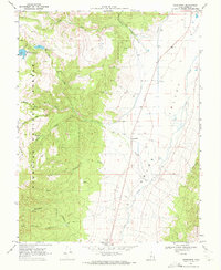
2011 Map of Abes Knoll
USGS Topo · Published 2011About this map
Otter Creek meanders through this high-altitude landscape dominated by an extensive network of water management features and seasonal roads. The terrain is characterized by numerous small-scale catchments including Fish Lake Reservoir, Windy Ridge Reservoir, and Deadman Hollow Reservoir. These reservoirs, alongside natural features like Parker Springs and Cabin Spring, reflect the vital importance of water rights and livestock management in this part of Utah. Elevated landmarks like Abes Knoll provide orientation within a landscape crossed by rugged routes such as Deadman Rd and Mytoge Mountain Rd. The distribution of features like Eightmile Reservoir and West Cedar Grove Reservoir suggests a geography shaped by ranching interests and the practicalities of maintaining water access across high-desert basins.
Find a feature on this map
16 named features on this map. Tap any name to fly to it.
Don’t see what you’re looking for? This feature index may not catch every label — zoom into the map to look around manually.
Map Details
Editions of this 2011 Abes Knoll Map
This is the sole edition of this map. No revisions or reprints were ever made.
Other maps of this area

1885 · Fish Lake
USGS Topo · 1:250,000

1896 · Fish Lake
USGS Topo · 1:250,000

1956 · Salina
USGS Topo · 1:250,000

1960 · Salina
USGS Topo · 1:250,000

1962 · Salina
USGS Topo · 1:250,000

1968 · Fish Lake
USGS Topo · 1:24,000
1968 · Koosharem
USGS Topo · 1:24,000
1968 · Burrville
USGS Topo · 1:24,000
1969 · Parker Knoll
USGS Topo · 1:24,000
1969 · Greenwich
USGS Topo · 1:24,000