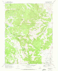
1968 Map of Koosharem
USGS Topo · Published 1972About this map
Grass Valley serves as the focal point for settlement and agriculture on this high-plateau map, where the small community of Koosharem sits near the Sevier and Piute County line. The valley floor is marked by a complex system of water management including a Canal and an Aqueduct to support local irrigation. To the west, the land rises sharply into the Fish Lake National Forest, dominated by the massive Cove Mountain. This transition from the structured fields of the valley to the wilder terrain of Monument Peak and Indian Peak illustrates the dual nature of the region's economy, balancing valley farming with upland grazing and timber. High-altitude landmarks like Magleby Pass and the isolated cabins at Milos Kitchen indicate the historical movement of people and livestock between the fertile lowlands and the rugged forest interior.
Find a feature on this map
51 named features on this map. Tap any name to fly to it.
Don’t see what you’re looking for? This feature index may not catch every label — zoom into the map to look around manually.
Map Details
Editions of this 1968 Koosharem Map
2 editions found
Other maps of this area

1885 · Beaver
USGS Topo · 1:250,000

1885 · Fish Lake
USGS Topo · 1:250,000

1896 · Fish Lake
USGS Topo · 1:250,000

1940 · Monroe
USGS Topo · 1:62,500

1944 · Monroe
USGS Topo · 1:62,500

1945 · Marysvale
USGS Topo · 1:62,500

1947 · Marysvale
USGS Topo · 1:62,500

1953 · Richfield
USGS Topo · 1:250,000

1956 · Salina
USGS Topo · 1:250,000

1958 · Richfield
USGS Topo · 1:250,000