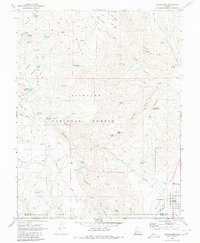
1968 Map of Koosharem
USGS Topo · Published 1980About this map
Fishlake National Forest dominates this high-altitude landscape of central Utah, where the rugged slopes of Cove Mountain transition into the agricultural basin of Grass Valley. The settlement of Koosharem serves as the primary hub, situated near the Koosharem Cem and an extensive irrigation network featuring a Canal and Aqueduct. This 1960s field-checked survey reveals a complex water management system essential for high-desert ranching, with numerous family-named landmarks like Magleby Reservoir, Wood Hollow Reservoir, and Magleby Pass suggesting the heritage of early settlers. The terrain is marked by distinct geological and pastoral features, from the heights of Indian Peak and Monument Peak down to the meadows at Milos Kitchen. Remote outposts such as the Koosharem Guard Station and scattered springs like Christensen Spring highlight the historical reliance on these vital water sources for livestock and timber operations.
Find a feature on this map
53 named features on this map. Tap any name to fly to it.
Don’t see what you’re looking for? This feature index may not catch every label — zoom into the map to look around manually.
Map Details
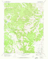
Editions of this 1968 Koosharem Map
2 editions found
Other maps of this area

1885 · Beaver
USGS Topo · 1:250,000

1885 · Fish Lake
USGS Topo · 1:250,000

1896 · Fish Lake
USGS Topo · 1:250,000

1940 · Monroe
USGS Topo · 1:62,500

1944 · Monroe
USGS Topo · 1:62,500

1945 · Marysvale
USGS Topo · 1:62,500

1947 · Marysvale
USGS Topo · 1:62,500

1953 · Richfield
USGS Topo · 1:250,000

1956 · Salina
USGS Topo · 1:250,000

1958 · Richfield
USGS Topo · 1:250,000