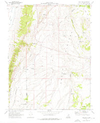
1969 Map of Abes Knoll
USGS Topo · Published 1976About this map
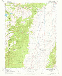
Awapa Plateau and the high ridges of Parker Mountain dominate this late-1960s landscape, where water management is the primary driver of development. The terrain is marked by an extensive network of small impoundments designed for livestock or irrigation, including Fish Lake Reservoir, Eightmile Reservoir, and Deadman Hollow Reservoir. In the southwest, the small settlement of Cedar Grove is located near West Cedar Grove Reservoir, serving as a rare focal point for human activity in a region largely defined by the Salt Lake Meridian and the border between Piute and Wayne Counties. The presence of a Radio Facility and numerous jeep trails cutting through Hatch Canyon reflects the mid-century infrastructure required to manage these highlands. This area, partly protected within the Fish Lake National Forest, shows a clear pattern of high-altitude ranching and resource management.
Find a feature on this map
33 named features on this map. Tap any name to fly to it.
Don’t see what you’re looking for? This feature index may not catch every label — zoom into the map to look around manually.
Map Details
Editions of this 1969 Abes Knoll Map
This is the sole edition of this map. No revisions or reprints were ever made.
Other maps of this area

1885 · Fish Lake
USGS Topo · 1:250,000

1896 · Fish Lake
USGS Topo · 1:250,000

1956 · Salina
USGS Topo · 1:250,000

1960 · Salina
USGS Topo · 1:250,000

1962 · Salina
USGS Topo · 1:250,000

1968 · Fish Lake
USGS Topo · 1:24,000
1968 · Koosharem
USGS Topo · 1:24,000
1968 · Burrville
USGS Topo · 1:24,000
1969 · Parker Knoll
USGS Topo · 1:24,000
1969 · Greenwich
USGS Topo · 1:24,000