2023 Map of Abeytas
USGS Topo · Published 2023About this map
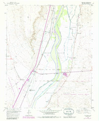
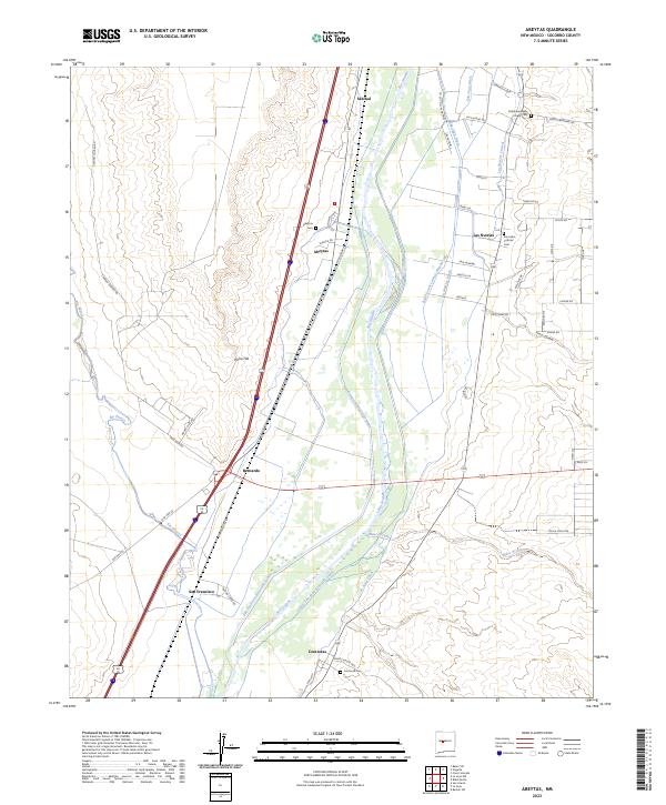
Rio Grande waters dominate this central New Mexico landscape, feeding an intricate network of irrigation channels like the San Juan Ditch and Belen Grant Lateral Number One. The valley floor is dotted with small agricultural settlements including Las Nutrias, Abeytas, and Bernardo, where rural life is grounded by local landmarks such as San Isidro Catholic Cem and the Chihuahua Bible Chapel. This survey reflects a complex water-management system essential for the high-desert climate, featuring multiple drains and laterals that parallel the river's course.
Find a feature on this map
60 named features on this map. Tap any name to fly to it.
Don’t see what you’re looking for? This feature index may not catch every label — zoom into the map to look around manually.
Map Details
Editions of this 2023 Abeytas Map
This is the sole edition of this map. No revisions or reprints were ever made.