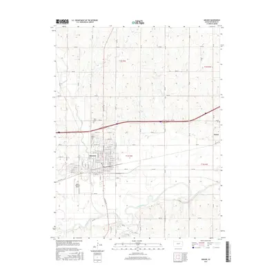
2015 Map of Abilene
USGS Topo · Published 2015About this map
Abilene serves as the central hub of this Dickinson County landscape, situated just north of the winding Smoky Hill River. The city's grid-based expansion is clearly defined, with N Buckeye Ave acting as a primary north-south artery. To the east lies the smaller community of Detroit, connected by the local road network that follows the section lines of the Public Land Survey System. The area's agricultural and civil heritage is marked by several burial grounds, including the Abilene Cem, Saint Joseph Cem, and Detroit Cem.
Find a feature on this map
89 named features on this map. Tap any name to fly to it.
Don’t see what you’re looking for? This feature index may not catch every label — zoom into the map to look around manually.
Map Details
Editions of this 2015 Abilene Map
This is the sole edition of this map. No revisions or reprints were ever made.
Other maps of this area

1889 · Abilene
USGS Topo · 1:125,000

1891 · Clay Center
USGS Topo · 1:125,000

1894 · Abilene
USGS Topo · 1:125,000

1955 · Manhattan
USGS Topo · 1:250,000

1955 · Hutchinson
USGS Topo · 1:250,000

1956 · Manhattan
USGS Topo · 1:250,000

1957 · Manhattan
USGS Topo · 1:250,000

1959 · Hutchinson
USGS Topo · 1:250,000
1963 · Upland
USGS Topo · 1:24,000

1963 · Abilene SW
USGS Topo · 1:24,000