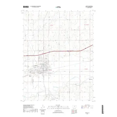
2018 Map of Abilene
USGS Topo · Published 2018About this map
The Smoky Hill River flows through this central Kansas landscape, winding eastward toward the community of Enterprise. This 2018 survey detail shows the city of Abilene as a major regional hub, characterized by a grid of numbered streets and avenues that extend north from the river valley. The geographic layout highlights the importance of water and transport, with Mud Cr joining the river near the city center, while Turkey Cr and Holland Cr drain the surrounding plains.
Find a feature on this map
88 named features on this map. Tap any name to fly to it.
Don’t see what you’re looking for? This feature index may not catch every label — zoom into the map to look around manually.
Map Details
Editions of this 2018 Abilene Map
This is the sole edition of this map. No revisions or reprints were ever made.
Other maps of this area

1889 · Abilene
USGS Topo · 1:125,000

1891 · Clay Center
USGS Topo · 1:125,000

1894 · Abilene
USGS Topo · 1:125,000

1955 · Manhattan
USGS Topo · 1:250,000

1955 · Hutchinson
USGS Topo · 1:250,000

1956 · Manhattan
USGS Topo · 1:250,000

1957 · Manhattan
USGS Topo · 1:250,000

1959 · Hutchinson
USGS Topo · 1:250,000
1963 · Upland
USGS Topo · 1:24,000

1963 · Abilene SW
USGS Topo · 1:24,000