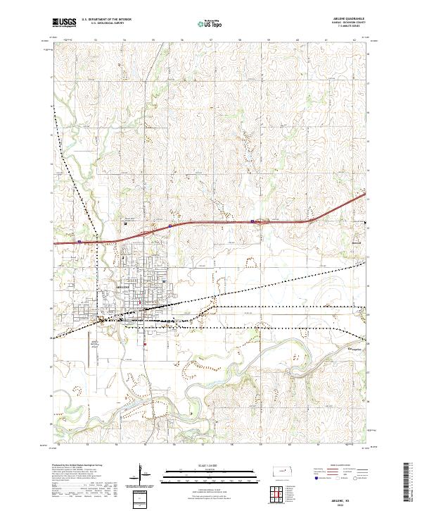
2022 Map of Abilene
USGS Topo · Published 2022About this map
The confluence of agricultural tradition and modern infrastructure is evident across the Abilene landscape. As the seat of Dickinson County, the town is anchored by the Dickinson County Courthouse and a dense residential grid that transitions into the expansive farmland of the central Kansas plains. The Smoky Hill River meanders along the southern edge of the city, joined by tributaries like Mud Cr and Turkey Cr, defining the low-lying drainage patterns that have shaped local development for generations.
Find a feature on this map
92 named features on this map. Tap any name to fly to it.
Don’t see what you’re looking for? This feature index may not catch every label — zoom into the map to look around manually.
Map Details
Editions of this 2022 Abilene Map
This is the sole edition of this map. No revisions or reprints were ever made.
Other maps of this area

1889 · Abilene
USGS Topo · 1:125,000

1891 · Clay Center
USGS Topo · 1:125,000

1894 · Abilene
USGS Topo · 1:125,000

1955 · Manhattan
USGS Topo · 1:250,000

1955 · Hutchinson
USGS Topo · 1:250,000

1956 · Manhattan
USGS Topo · 1:250,000

1957 · Manhattan
USGS Topo · 1:250,000

1959 · Hutchinson
USGS Topo · 1:250,000
1963 · Upland
USGS Topo · 1:24,000

1963 · Abilene SW
USGS Topo · 1:24,000