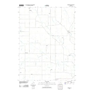
2010 Map of Abingdon
USGS Topo · Published 2010About this map
The Iowa settlements of Abingdon, Competine, and Bladensburg anchor this rural landscape where small-town life meets a dense network of local creeks. For genealogists and local historians, the sheet is exceptionally dense with burial sites, including Abingdon Cemetery, Competine Cemetery, and the centrally located Schrom Cemetery. The terrain is defined by the drainage of Cedar Creek and Competine Creek, which wind through a grid of secondary roads such as Jefferson Keokuk and Batavia Rd. The map illustrates a traditional Midwestern agricultural layout, where isolated settlements like Yampa are connected by a web of avenues and streets. Notable water features like Honey Creek and Buckeye Creek highlight the natural irrigation system that has long supported this region's farming heritage.
Find a feature on this map
55 named features on this map. Tap any name to fly to it.
Don’t see what you’re looking for? This feature index may not catch every label — zoom into the map to look around manually.
Map Details
Editions of this 2010 Abingdon Map
This is the sole edition of this map. No revisions or reprints were ever made.
Other maps of this area

1954 · Centerville
USGS Topo · 1:250,000

1954 · Des Moines
USGS Topo · 1:250,000

1956 · Des Moines
USGS Topo · 1:250,000

1956 · Farson
USGS Topo · 1:24,000

1956 · Agency
USGS Topo · 1:24,000

1956 · Ottumwa North
USGS Topo · 1:62,500

1956 · Ottumwa South
USGS Topo · 1:62,500

1957 · Des Moines
USGS Topo · 1:250,000

1957 · Centerville
USGS Topo · 1:250,000

1958 · Centerville
USGS Topo · 1:250,000