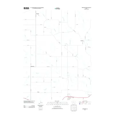
2013 Map of Abingdon
USGS Topo · Published 2013About this map
Abingdon and Bladensburg anchor this rural landscape in Jefferson County, where the topography is defined by an intricate network of waterways draining toward the south and east. The drainage pattern is led by Cedar Cr and Competine Cr, which are fed by numerous smaller tributaries including Little Competine Cr, Buckeye Cr, and Honey Cr. These creeks dictate the winding paths of local roads that deviate from the standard Jefferson County grid, such as Batavia Rd and Brookville Rd. Smaller settlements like Competine in the northwest and Yampa in the south reflect the enduring agricultural character of the region. The map reveals the relationship between the low-lying creek bottoms and the upland farmsteads, providing a clear view of the area's rural infrastructure and small-town junctions.
Find a feature on this map
60 named features on this map. Tap any name to fly to it.
Don’t see what you’re looking for? This feature index may not catch every label — zoom into the map to look around manually.
Map Details
Editions of this 2013 Abingdon Map
This is the sole edition of this map. No revisions or reprints were ever made.
Other maps of this area

1954 · Centerville
USGS Topo · 1:250,000

1954 · Des Moines
USGS Topo · 1:250,000

1956 · Des Moines
USGS Topo · 1:250,000

1956 · Farson
USGS Topo · 1:24,000

1956 · Agency
USGS Topo · 1:24,000

1956 · Ottumwa North
USGS Topo · 1:62,500

1956 · Ottumwa South
USGS Topo · 1:62,500

1957 · Des Moines
USGS Topo · 1:250,000

1957 · Centerville
USGS Topo · 1:250,000

1958 · Centerville
USGS Topo · 1:250,000