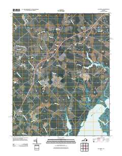
2011 Map of Accomac
USGS Topo · Published 2011About this map
The town of Accomac and the waterfront community of Onancock anchor this detailed study of Virginia's Eastern Shore. This coastal landscape is defined by its deep saltwater incursions and family-named landmarks, where the shoreline dissolves into Burtons Bay and Cedar Island Bay. The interior is a dense network of small crossroads settlements like Tasley, Allentown, and Locustville, many tied to the regional transport spine of the era. Genealogists will find significant value in the documentation of several local burial grounds, including Edge Hill Cemetery and Mount Holly Cemetery. Along the coast, the map identifies specific geographic features like Joynes Neck and Baylys Neck, alongside infrastructure such as the Onley Airport and multiple post offices serving the surrounding farming and maritime communities. The transition from the mainland through the Great Channel to Cedar Island captures the delicate relationship between the shore and the Atlantic barrier islands.
Find a feature on this map
54 named features on this map. Tap any name to fly to it.
Don’t see what you’re looking for? This feature index may not catch every label — zoom into the map to look around manually.
Map Details
Editions of this 2011 Accomac Map
This is the sole edition of this map. No revisions or reprints were ever made.
Other maps of this area

1903 · Crisfield
USGS Topo · 1:62,500

1920 · Crisfield
USGS Topo · 1:62,500

1931 · Accomac
USGS Topo · 1:48,000

1935 · Accomac
USGS Topo · 1:62,500

1942 · Chesconessex
USGS Topo · 1:31,680

1942 · Mappsville
USGS Topo · 1:24,000

1942 · Parksley
USGS Topo · 1:24,000

1943 · Pungoteague
USGS Topo · 1:31,680

1943 · Parksley
USGS Topo · 1:31,680

1943 · Mappsville
USGS Topo · 1:31,680