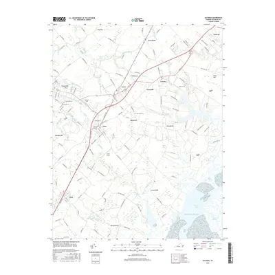
2016 Map of Accomac
USGS Topo · Published 2016About this map
Onancock and Accomac anchor this Eastern Shore landscape, illustrating the proximity of historical harbors to inland county seats. The terrain is defined by the branching tidal creeks of the Atlantic Ocean, with Burtons Bay and the Great Channel shaping the eastern shoreline. Between these waters and the Chesapeake drainage to the west, a network of small settlements like Tasley, Onley, and Melfa follows the central transportation corridor. Local history is deeply etched into the land through numerous small burial grounds, including the Allen Family Cem and Edge Hill Cem. The presence of Onley Airport and Johnson Field highlights the role of aviation in this maritime-agricultural region. The map also reveals how water features like Custis Cr and Finney Cr create natural boundaries between named necks of land such as Baylys Neck and Custis Neck.
Find a feature on this map
152 named features on this map. Tap any name to fly to it.
Don’t see what you’re looking for? This feature index may not catch every label — zoom into the map to look around manually.
Map Details
Editions of this 2016 Accomac Map
This is the sole edition of this map. No revisions or reprints were ever made.
Other maps of this area

1903 · Crisfield
USGS Topo · 1:62,500

1920 · Crisfield
USGS Topo · 1:62,500

1931 · Accomac
USGS Topo · 1:48,000

1935 · Accomac
USGS Topo · 1:62,500

1942 · Chesconessex
USGS Topo · 1:31,680

1942 · Mappsville
USGS Topo · 1:24,000

1942 · Parksley
USGS Topo · 1:24,000

1943 · Pungoteague
USGS Topo · 1:31,680

1943 · Parksley
USGS Topo · 1:31,680

1943 · Mappsville
USGS Topo · 1:31,680