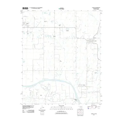
2010 Map of Achille
USGS Topo · Published 2010About this map
The Red River marks the boundary between Oklahoma and Texas on this 2010 survey, anchoring a landscape shaped by water management and rural settlement. In Bryan County, Oklahoma, the town of Achille sits at the junction of e2190 RD and N 3725, while the small community of Hendrix lies just north of the river bend. The terrain is crisscrossed by several vital waterways, including Sandy Creek, Webb Creek, and Rock Creek, many of which are controlled by structures like the McCarley Lake Dam and Kemp Lake Dam.
Find a feature on this map
51 named features on this map. Tap any name to fly to it.
Don’t see what you’re looking for? This feature index may not catch every label — zoom into the map to look around manually.
Map Details
Editions of this 2010 Achille Map
This is the sole edition of this map. No revisions or reprints were ever made.
Other maps of this area

1901 · Denison
USGS Topo · 1:125,000

1954 · Sherman
USGS Topo · 1:250,000

1957 · Denison Dam
USGS Topo · 1:24,000

1958 · Durant
USGS Topo · 1:62,500

1958 · Whitesright
USGS Topo · 1:62,500

1958 · Denison Dam
USGS Topo · 1:62,500

1958 · Sherman
USGS Topo · 1:250,000

1958 · Sherman
USGS Topo · 1:62,500

1958 · Sherman
USGS Topo · 1:24,000
1980 · Durant South
USGS Topo · 1:24,000