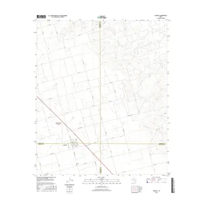
2016 Map of Ackerly
USGS Topo · Published 2016About this map
Ackerly stands as the primary community on this High Plains landscape, uniquely positioned at the intersection of four Texas counties: Dawson, Martin, Howard, and Borden. The town's layout is clearly defined by its numbered streets and avenues, serving as a hub for the surrounding ranching and agricultural lands. Evidence of the region's ranching economy is found at the Coleman Cattle Company Number 1 Airport, while the Fairhaven Cem provides a point of genealogical interest just south of the town center.
Find a feature on this map
65 named features on this map. Tap any name to fly to it.
Don’t see what you’re looking for? This feature index may not catch every label — zoom into the map to look around manually.
Map Details
Editions of this 2016 Ackerly Map
This is the sole edition of this map. No revisions or reprints were ever made.
Other maps of this area

1954 · Big Spring
USGS Topo · 1:250,000

1958 · Big Spring
USGS Topo · 1:250,000

1966 · Knott
USGS Topo · 1:24,000

1966 · Merrick
USGS Topo · 1:24,000

1966 · Knott NE
USGS Topo · 1:24,000

1970 · Vealmoor
USGS Topo · 1:24,000

1970 · Ackerly
USGS Topo · 1:24,000

1970 · Key
USGS Topo · 1:24,000

1970 · Sand Creek
USGS Topo · 1:24,000
1970 · Sparenberg
USGS Topo · 1:24,000