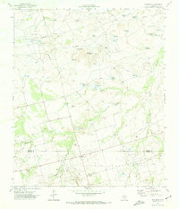
1970 Map of Sand Creek
USGS Topo · Published 1974About this map
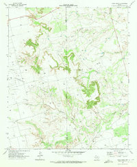
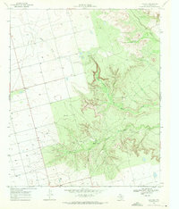
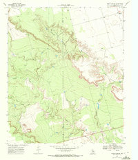
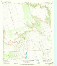
The Spraberry Oil Field dominates the landscape of this West Texas region, illustrating the intense petroleum exploration in Borden County during the early 1970s. This survey, compiled from 1969 aerial photography, reveals a dense network of Oil Wells and access roads that puncture the high plains. The drainage systems of Sand Creek, Tobacco Creek, and Gold Creek carve deep into the terrain, eventually feeding toward the Colorado River in the south. Scattered settlements like Wasson and Southard 2 appear near the Dawson County and Borden County line, serving as small hubs in an area otherwise dedicated to resource extraction. The map also highlights the distinct topography of Black Canyon and the winding course of Crane Draw, providing a precise look at the land before further industrial development altered the natural drainage patterns of these semi-arid breaks.
Find a feature on this map
19 named features on this map. Tap any name to fly to it.
Don’t see what you’re looking for? This feature index may not catch every label — zoom into the map to look around manually.
Map Details
Editions of this 1970 Sand Creek Map
This is the sole edition of this map. No revisions or reprints were ever made.
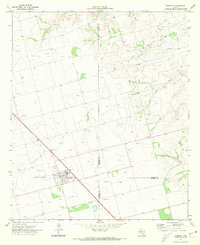
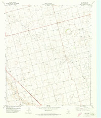
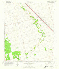
Other maps of this area

1954 · Big Spring
USGS Topo · 1:250,000

1958 · Big Spring
USGS Topo · 1:250,000
1968 · Hancock
USGS Topo · 1:24,000
1969 · Indian Canyon
USGS Topo · 1:24,000
1969 · Holloway Canyon
USGS Topo · 1:24,000
1970 · Vealmoor
USGS Topo · 1:24,000
1970 · Ackerly
USGS Topo · 1:24,000
1970 · Key
USGS Topo · 1:24,000
1970 · Sparenberg
USGS Topo · 1:24,000

1970 · Long Draw
USGS Topo · 1:24,000