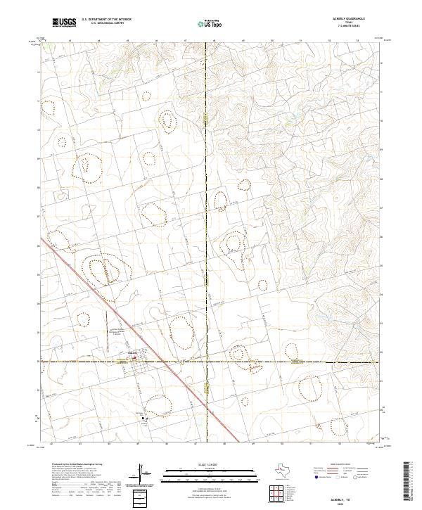
2022 Map of Ackerly
USGS Topo · Published 2022About this map
Ackerly sits at a rare four-county convergence in West Texas, where the boundaries of Dawson, Borden, Martin, and Howard counties meet. This agricultural landscape is defined by its rectilinear road grid, dominated by routes like Ranch Rd 1584 and Farm Rd 2002-E that service the surrounding cattle and ranching operations. The Coleman Cattle Company Number 1 Airport north of the town center highlights the importance of aviation in managing these large territorial holdings.
Find a feature on this map
34 named features on this map. Tap any name to fly to it.
Don’t see what you’re looking for? This feature index may not catch every label — zoom into the map to look around manually.
Map Details
Editions of this 2022 Ackerly Map
This is the sole edition of this map. No revisions or reprints were ever made.
Other maps of this area

1954 · Big Spring
USGS Topo · 1:250,000

1958 · Big Spring
USGS Topo · 1:250,000

1966 · Knott
USGS Topo · 1:24,000

1966 · Merrick
USGS Topo · 1:24,000

1966 · Knott NE
USGS Topo · 1:24,000

1970 · Vealmoor
USGS Topo · 1:24,000

1970 · Ackerly
USGS Topo · 1:24,000

1970 · Key
USGS Topo · 1:24,000

1970 · Sand Creek
USGS Topo · 1:24,000
1970 · Sparenberg
USGS Topo · 1:24,000