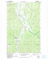
1980 Map of Acme
USGS Topo · Published 1992About this map
The South Fork Nooksack River valley defines this region of Whatcom and Skagit counties, where timber and transit shaped the landscape. In the center of the valley, the settlement of Acme sits near a Landing Strip, while further south, Wickersham serves as a junction near the Mirror Lake Siding. The map reveals the legacy of local infrastructure, including an Old Railroad Grade and the Saxon Bridge crossing the river near the Saxon Cem. On the valley's edges, the terrain rises sharply toward Blue Mountain and Eddys Mountain. This 1980 survey captures the area's mix of industry and agriculture, featuring a Fish Hatchery along Skookum Creek and scattered industrial sites like a Gravel Pit and a Quarry. Local genealogists will find value in the named homestead roads and small family-associated landmarks that persisted through the late twentieth century.
Find a feature on this map
38 named features on this map. Tap any name to fly to it.
Don’t see what you’re looking for? This feature index may not catch every label — zoom into the map to look around manually.
Map Details
Editions of this 1980 Acme Map
2 editions found
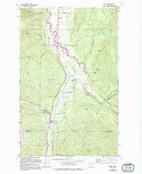
Other maps of this area

1906 · Sumas
USGS Topo · 1:62,500

1908 · Sumas
USGS Topo · 1:62,500

1918 · Samish Lake
USGS Topo · 1:62,500

1919 · Van Zandt
USGS Topo · 1:62,500

1921 · Wickersham
USGS Topo · 1:62,500

1951 · Wickersham
USGS Topo · 1:62,500

1951 · Van Zandt
USGS Topo · 1:62,500

1952 · Lake Whatcom
USGS Topo · 1:24,000

1952 · Lawrence
USGS Topo · 1:24,000

1952 · Alger
USGS Topo · 1:24,000