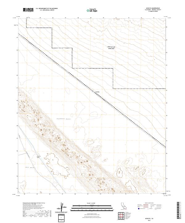
2021 Map of Acolita
USGS Topo · Published 2021About this map
Acolita sits at the northern edge of the dramatic Algodones Dunes system in eastern Imperial County, a landscape defined by the stark transition between desert sands and the managed water of the Imperial Valley. The 2021 survey traces the vital path of the Coachella Canal, which skirts the western edge of the dunes near East Mesa. This desert corridor is primarily accessed by a network of dirt routes including Ted Kipf Rd and Coachella Canal Rd, which parallel the major water infrastructure. The map reveals the intricate topography of the dune field itself, showing how the shifting sands interface with the flatter desert floor to the west. This area represents a critical point of California's agricultural history, where modern engineering and natural desert formations meet along the canal line.
Find a feature on this map
13 named features on this map. Tap any name to fly to it.
Don’t see what you’re looking for? This feature index may not catch every label — zoom into the map to look around manually.
Map Details
Editions of this 2021 Acolita Map
This is the sole edition of this map. No revisions or reprints were ever made.
Other maps of this area

1907 · Holtville
USGS Topo · 1:125,000

1940 · Iris
USGS Topo · 1:62,500

1940 · Alamorio
USGS Topo · 1:62,500

1942 · El Centro
USGS Topo · 1:250,000

1945 · Alamorio
USGS Topo · 1:62,500

1945 · Iris
USGS Topo · 1:62,500

1953 · Acolita
USGS Topo · 1:24,000

1953 · Acolita
USGS Topo · 1:62,500

1954 · El Centro
USGS Topo · 1:250,000

1954 · Salton Sea
USGS Topo · 1:250,000