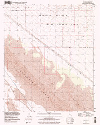
1998 Map of Acolita
USGS Topo · Published 2002About this map
The Chocolate Mountain Aerial Gunnery Range dominates the northern half of this landscape, reflecting the military's long-standing footprint in the California desert. Running southeast through the center of the sheet, the Niland-Glamis Road follows the boundary of the military reservation, passing the small settlement of Acolita. To the south, the terrain shifts into the shifting sands of the Algodones Dunes, an expansive dune system that contrasts with the rocky slopes of Chocolate Mountain above. The introduction of water into this arid environment is represented by the Coachella Canal, which skirts the edge of the East Mesa. This infrastructure highlights the mid-century efforts to reclaim desert lands for agricultural and industrial use, even as large swaths remained dedicated to defense training operations.
Find a feature on this map
12 named features on this map. Tap any name to fly to it.
Don’t see what you’re looking for? This feature index may not catch every label — zoom into the map to look around manually.
Map Details
Editions of this 1998 Acolita Map
This is the sole edition of this map. No revisions or reprints were ever made.
Other maps of this area

1907 · Holtville
USGS Topo · 1:125,000

1940 · Iris
USGS Topo · 1:62,500

1940 · Alamorio
USGS Topo · 1:62,500

1942 · El Centro
USGS Topo · 1:250,000

1945 · Alamorio
USGS Topo · 1:62,500

1945 · Iris
USGS Topo · 1:62,500

1953 · Acolita
USGS Topo · 1:24,000

1953 · Acolita
USGS Topo · 1:62,500

1954 · El Centro
USGS Topo · 1:250,000

1954 · Salton Sea
USGS Topo · 1:250,000