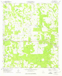
1973 Map of Acree
USGS Topo · Published 1975About this map
The Seaboard Coast Line railroad creates a distinct horizontal axis across this landscape, connecting the small settlement of Acree to the rural expanses of Dougherty and Worth counties. The area is characterized by a dense network of local places of worship, including Salem, Beulah, and Morning Star churches, which served as the primary social anchors for these agricultural communities in the early 1970s.
Find a feature on this map
25 named features on this map. Tap any name to fly to it.
Don’t see what you’re looking for? This feature index may not catch every label — zoom into the map to look around manually.
Map Details
Editions of this 1973 Acree Map
2 editions found
Other maps of this area

1953 · Dothan
USGS Topo · 1:250,000

1953 · Waycross
USGS Topo · 1:250,000

1954 · Dothan
USGS Topo · 1:250,000

1955 · Dothan
USGS Topo · 1:250,000

1956 · Albany East
USGS Topo · 1:24,000

1956 · Baconton
USGS Topo · 1:62,500

1956 · Sylvester
USGS Topo · 1:62,500

1956 · Doerun
USGS Topo · 1:62,500

1956 · Albany
USGS Topo · 1:62,500

1958 · Waycross
USGS Topo · 1:250,000