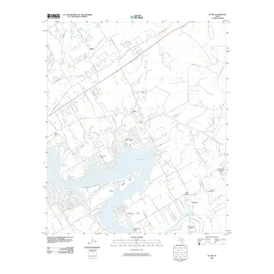
2010 Map of Acton
USGS Topo · Published 2010About this map
Lake Granbury dominates the central landscape of this 2010 survey, illustrating the significant hydrological development of the Brazos River in Hood County. The intricate shoreline, shaped by numerous inlets such as Lusk Branch and McCarthy Branch, is flanked by residential growth in DeCordova and Acton. This area shows a transition from historical rural community centers to a modern recreation-oriented landscape, evidenced by the Nassau Bay Airport and various waterfront developments.
Find a feature on this map
81 named features on this map. Tap any name to fly to it.
Don’t see what you’re looking for? This feature index may not catch every label — zoom into the map to look around manually.
Map Details
Editions of this 2010 Acton Map
This is the sole edition of this map. No revisions or reprints were ever made.
Other maps of this area

1889 · Granbury
USGS Topo · 1:125,000

1891 · Weatherford
USGS Topo · 1:125,000

1893 · Weatherford
USGS Topo · 1:125,000

1923 · Granbury 2-a
USGS Topo · 1:48,000

1923 · Granbury 1-b
USGS Topo · 1:48,000

1924 · Weatherford 3-d
USGS Topo · 1:48,000

1924 · Granbury 1-c
USGS Topo · 1:48,000

1928 · Godley
USGS Topo · 1:62,500

1931 · Dennis
USGS Topo · 1:62,500

1931 · Tolar
USGS Topo · 1:62,500