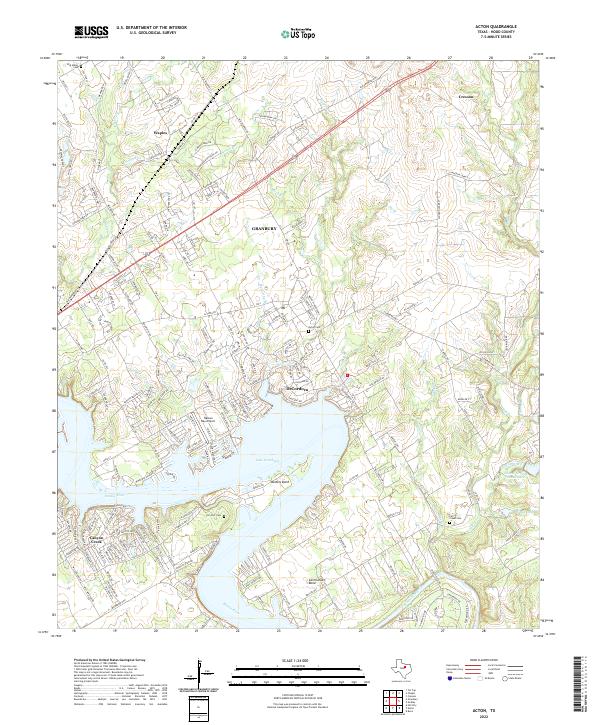
2022 Map of Acton
USGS Topo · Published 2022About this map
The Brazos River creates a dramatic series of oxbows and bends through this section of Hood County, most notably at Walters Bend and Carmichael Bend. The landscape is dominated by the sprawling waters of Lake Granbury, which has transformed the river valley into a residential and recreational hub. Along its northern shores, the community of DeCordova and the Nassau Bay Airport show the modern development of the area, while the southern banks near Canyon Creek feature dense neighborhood platting.
Find a feature on this map
201 named features on this map. Tap any name to fly to it.
Don’t see what you’re looking for? This feature index may not catch every label — zoom into the map to look around manually.
Map Details
Editions of this 2022 Acton Map
This is the sole edition of this map. No revisions or reprints were ever made.
Other maps of this area

1889 · Granbury
USGS Topo · 1:125,000

1891 · Weatherford
USGS Topo · 1:125,000

1893 · Weatherford
USGS Topo · 1:125,000

1923 · Granbury 2-a
USGS Topo · 1:48,000

1923 · Granbury 1-b
USGS Topo · 1:48,000

1924 · Weatherford 3-d
USGS Topo · 1:48,000

1924 · Granbury 1-c
USGS Topo · 1:48,000

1928 · Godley
USGS Topo · 1:62,500

1931 · Dennis
USGS Topo · 1:62,500

1931 · Tolar
USGS Topo · 1:62,500