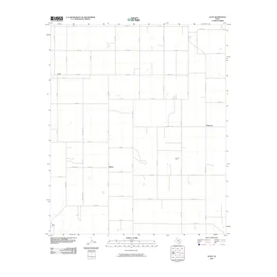
2010 Map of Acuff
USGS Topo · Published 2010About this map
The high plains of Lubbock County are defined by a strict grid of section roads and agricultural infrastructure as they appeared in 2010. The community of Acuff serves as a primary reference point in the northwest, while the settlement of Midway sits at a crossroads further south. The landscape is primarily organized around small-scale oil extraction and ranching, evidenced by the presence of the Ha-Ra Oil Field and the S-Bar Ranch in the southwestern corner. Regional connectivity is maintained through named thoroughfares such as Acuff Rd and Winniford Rd, which cut through the flat terrain between clusters of farmsteads. Near the eastern margin, the small settlement of Robertson marks another localized hub within this expansive rural network.
Find a feature on this map
47 named features on this map. Tap any name to fly to it.
Don’t see what you’re looking for? This feature index may not catch every label — zoom into the map to look around manually.
Map Details
Editions of this 2010 Acuff Map
This is the sole edition of this map. No revisions or reprints were ever made.
Other maps of this area

1954 · Lubbock
USGS Topo · 1:250,000

1965 · Acuff
USGS Topo · 1:24,000

1965 · Slaton
USGS Topo · 1:24,000

1965 · Buffalo Springs Lake
USGS Topo · 1:24,000

1965 · Slaton NE
USGS Topo · 1:24,000

1965 · Idalou
USGS Topo · 1:24,000

1965 · Lorenzo
USGS Topo · 1:24,000

1966 · Cap Rock
USGS Topo · 1:24,000

1967 · Ralls
USGS Topo · 1:24,000

1967 · Savage
USGS Topo · 1:24,000