
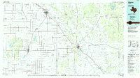
1967 Map of Savage
USGS Topo · Published 1968About this map
Savage and its surrounding agricultural lands are captured here during a period of steady groundwater-dependent farming. The landscape is dotted with numerous points labeled well, indicating the critical reliance on the Ogallala Aquifer for this portion of the Texas Panhandle. Historical markers like the Old Emma Cem preserve the memory of earlier frontier settlements, while the presence of a Landing Strip and multiple Gravel Pits reflects the mid-century infrastructure supporting the local rural economy. The topography is characterized by shallow depressions and gentle elevations typical of the Llano Estacado, where small-scale industrial sites like a Gravel Pit punctuate the vast stretches of ranch and farmland.
Find a feature on this map
6 named features on this map. Tap any name to fly to it.
Don’t see what you’re looking for? This feature index may not catch every label — zoom into the map to look around manually.
Map Details
Editions of this 1967 Savage Map
This is the sole edition of this map. No revisions or reprints were ever made.
Other maps of this area

1954 · Lubbock
USGS Topo · 1:250,000

1965 · Acuff
USGS Topo · 1:24,000

1965 · Slaton NE
USGS Topo · 1:24,000

1965 · Lorenzo
USGS Topo · 1:24,000

1966 · Cap Rock
USGS Topo · 1:24,000

1966 · Canyon Valley
USGS Topo · 1:24,000

1967 · Ralls SE
USGS Topo · 1:24,000

1967 · Ralls NE
USGS Topo · 1:24,000

1967 · Ralls
USGS Topo · 1:24,000
1986 · Slaton
USGS Topo · 1:100,000