
1965 Map of Lorenzo
USGS Topo · Published 1966About this map
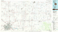
The high plains of the Texas Panhandle are documented here along the Lubbock Co Crosby Co line, capturing a landscape defined by industrial agriculture and small-town growth. The town of Lorenzo serves as the primary hub, where the Atchison Topeka and Santa Fe railroad cuts through the center of the community, supporting local commerce evidenced by the Cotton Gin. This mid-1960s survey reveals the social infrastructure of the era, from the Ralph Bunche Sch and High Sch to the Hornet Stadium and the local Golf Course. To the north, the settlement of Estacado represents the region's early history, accompanied by the Estacado Cem. The terrain is marked by numerous Wells and depressions typical of the Llano Estacado, including a Sewage Disposal Pond and an early Lorenzo Airfield.
Find a feature on this map
16 named features on this map. Tap any name to fly to it.
Don’t see what you’re looking for? This feature index may not catch every label — zoom into the map to look around manually.
Map Details
Editions of this 1965 Lorenzo Map
This is the sole edition of this map. No revisions or reprints were ever made.
Other maps of this area

1954 · Lubbock
USGS Topo · 1:250,000

1965 · Acuff
USGS Topo · 1:24,000

1965 · Buffalo Springs Lake
USGS Topo · 1:24,000

1965 · Idalou
USGS Topo · 1:24,000

1965 · Petersburg
USGS Topo · 1:24,000

1965 · Heckville
USGS Topo · 1:24,000

1965 · Cone
USGS Topo · 1:24,000

1967 · Ralls
USGS Topo · 1:24,000

1967 · Savage
USGS Topo · 1:24,000
1986 · Lubbock
USGS Topo · 1:100,000