
1965 Map of Petersburg
USGS Topo · Published 1966About this map
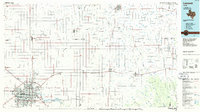
Petersburg occupies the northwestern corner of this 1960s survey, showing a structured town grid adjacent to a Landing Strip and a Cemetery. The local infrastructure is shaped by the Fort Worth and Denver railroad line cutting through the plains toward the county lines. This map effectively illustrates the early 1960s industrial footprint of the South Plains, including a Pipeline network and Sewage Disposal Ponds southeast of the main settlement. Near the southern border, the small community of Estacado is situated at the junction of the Lubbock and Crosby county lines. The landscape is characterized by numerous depressions and localized basins typical of the Llano Estacado, many containing small seasonal water features or wells that supported the region's agricultural activity.
Find a feature on this map
12 named features on this map. Tap any name to fly to it.
Don’t see what you’re looking for? This feature index may not catch every label — zoom into the map to look around manually.
Map Details
Editions of this 1965 Petersburg Map
This is the sole edition of this map. No revisions or reprints were ever made.
Other maps of this area

1954 · Lubbock
USGS Topo · 1:250,000

1965 · Idalou
USGS Topo · 1:24,000

1965 · Lorenzo
USGS Topo · 1:24,000

1965 · Heckville
USGS Topo · 1:24,000

1965 · Cone
USGS Topo · 1:24,000

1965 · Sandhill
USGS Topo · 1:24,000

1967 · Ralls
USGS Topo · 1:24,000

1968 · Barwise
USGS Topo · 1:24,000

1968 · Julia Lake
USGS Topo · 1:24,000
1986 · Lubbock
USGS Topo · 1:100,000