
1968 Map of Julia Lake
USGS Topo · Published 1970About this map
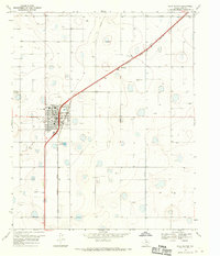
Julia Lake and the winding course of Crawfish Draw dominate this portion of the Texas High Plains in Hale County. The landscape is defined by its agricultural and industrial utility during the late 1960s, punctuated by numerous Wells and an isolated Oil Well that signify the region's reliance on groundwater and mineral extraction. Near the southern edge of the sheet, the Lakeview Ch stands as a focal point for the local rural community, while family-named benchmarks such as Stewart RM 1 and Stewart 2 provide specific points of interest for genealogists and local historians tracking land use and property boundaries. The presence of Gravel Pits in the northeast indicates active resource harvesting in an area otherwise characterized by steady topographic depressions and intermittent water features typical of the Llano Estacado.
Find a feature on this map
9 named features on this map. Tap any name to fly to it.
Don’t see what you’re looking for? This feature index may not catch every label — zoom into the map to look around manually.
Map Details
Editions of this 1968 Julia Lake Map
This is the sole edition of this map. No revisions or reprints were ever made.
Other maps of this area

1954 · Lubbock
USGS Topo · 1:250,000

1954 · Plainview
USGS Topo · 1:250,000

1957 · Abernathy
USGS Topo · 1:62,500

1958 · Plainview
USGS Topo · 1:250,000

1965 · Petersburg
USGS Topo · 1:24,000

1965 · Heckville
USGS Topo · 1:24,000

1968 · Happy Union
USGS Topo · 1:24,000

1968 · Barwise
USGS Topo · 1:24,000

1968 · Plainview SE
USGS Topo · 1:24,000
1968 · Hale Center
USGS Topo · 1:24,000