
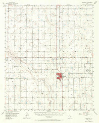
1957 Map of Abernathy
USGS Topo · Published 1958About this map
Abernathy serves as the primary hub on this South Plains landscape during the late 1950s, bisected by the Panhandle and Santa Fe railroad and a major highway. The surrounding High Plains terrain is marked by numerous depression-like features and the upper reaches of the Double Mountain Fork Brazos River. This era shows a transition toward heavy industrial and military activity, evidenced by the Lutrick Oil Field to the east and the Auxiliary Landing Field (Reese Air Force Base) near the Hale and Lubbock County line.
Find a feature on this map
22 named features on this map. Tap any name to fly to it.
Don’t see what you’re looking for? This feature index may not catch every label — zoom into the map to look around manually.
Map Details
Editions of this 1957 Abernathy Map
2 editions found
Other maps of this area

1954 · Lubbock
USGS Topo · 1:250,000

1954 · Plainview
USGS Topo · 1:250,000

1954 · Clovis
USGS Topo · 1:250,000

1954 · Brownfield
USGS Topo · 1:250,000

1956 · Shallowater
USGS Topo · 1:24,000

1956 · New Deal
USGS Topo · 1:24,000

1957 · Lubbock
USGS Topo · 1:62,500

1957 · Anton
USGS Topo · 1:62,500

1957 · Wolfforth
USGS Topo · 1:62,500

1958 · Brownfield
USGS Topo · 1:250,000