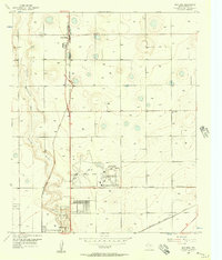
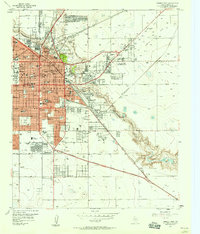
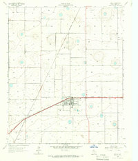
1956 Map of New Deal
USGS Topo · Published 1957About this map
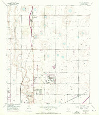
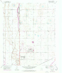
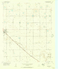
The Double Mountain Fork Brazos River cuts a distinct path through the High Plains landscape just north of Lubbock, where the 1950s economy was defined by a combination of agriculture, aviation, and expanding industry. The Lubbock Municipal Airport serves as a central hub, detailed with its Administration Bldg and Hangars, adjacent to the emerging City of Lubbock Industrial Area. Transport corridors are dominated by the Panhandle and Santa Fe Railway and U.S. 87, which anchor the small settlement of New Deal. The map also captures local recreation at the Lubbock Country Club and early resource extraction at various Gravel Pits along the river's edge. Numerous wells are scattered across the quadrangle, illustrating the vital role of groundwater in sustaining the region's farms and small communities like Liberty.
Find a feature on this map
38 named features on this map. Tap any name to fly to it.
Don’t see what you’re looking for? This feature index may not catch every label — zoom into the map to look around manually.
Map Details
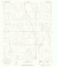
Editions of this 1956 New Deal Map
3 editions found
Other maps of this area

1954 · Lubbock
USGS Topo · 1:250,000
1956 · Shallowater
USGS Topo · 1:24,000
1957 · Lubbock East
USGS Topo · 1:24,000
1957 · Lubbock West
USGS Topo · 1:24,000

1957 · Lubbock
USGS Topo · 1:62,500
1957 · Abernathy
USGS Topo · 1:62,500
1965 · Buffalo Springs Lake
USGS Topo · 1:24,000
1965 · Idalou
USGS Topo · 1:24,000
1965 · Heckville
USGS Topo · 1:24,000
1976 · Abernathy SE
USGS Topo · 1:24,000