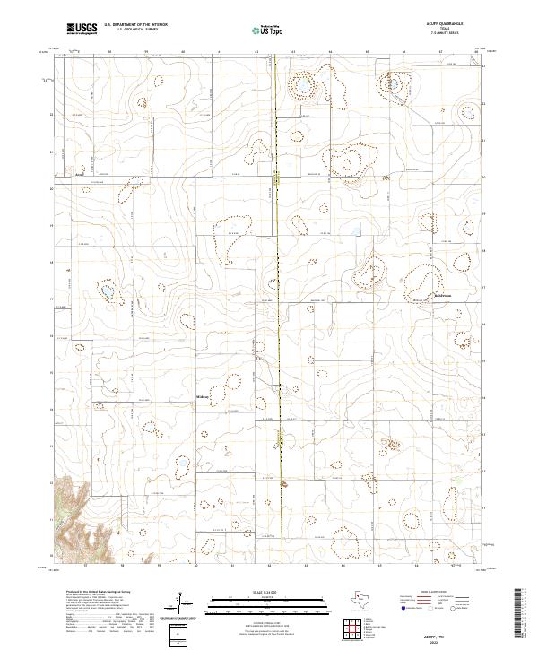
2022 Map of Acuff
USGS Topo · Published 2022About this map
Acuff anchors the western edge of this High Plains landscape, situated along the county line where Lubbock Co meets Crosby Co. The survey reveals a highly organized agricultural grid defined by a network of farm-to-market roads, including Fm 789 and E Fm 40, which facilitate movement between the small settlements and rural homesteads. The terrain is characterized by numerous small depressions and playas, a distinctive feature of the Llano Estacado, which break up the geometric precision of the crop lands.
Find a feature on this map
56 named features on this map. Tap any name to fly to it.
Don’t see what you’re looking for? This feature index may not catch every label — zoom into the map to look around manually.
Map Details
Editions of this 2022 Acuff Map
This is the sole edition of this map. No revisions or reprints were ever made.
Other maps of this area

1954 · Lubbock
USGS Topo · 1:250,000

1965 · Acuff
USGS Topo · 1:24,000

1965 · Slaton
USGS Topo · 1:24,000

1965 · Buffalo Springs Lake
USGS Topo · 1:24,000

1965 · Slaton NE
USGS Topo · 1:24,000

1965 · Idalou
USGS Topo · 1:24,000

1965 · Lorenzo
USGS Topo · 1:24,000

1966 · Cap Rock
USGS Topo · 1:24,000

1967 · Ralls
USGS Topo · 1:24,000

1967 · Savage
USGS Topo · 1:24,000