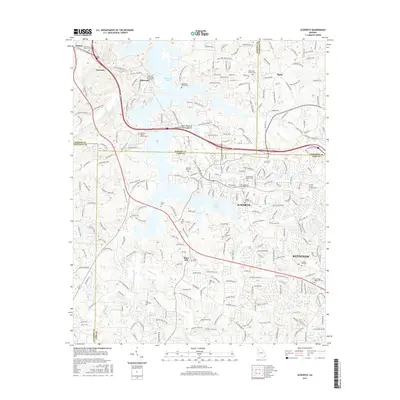
2017 Map of Acworth
USGS Topo · Published 2017About this map
Acworth and the northern reaches of Kennesaw are shown here as the suburbs of Atlanta extend into the foothills of North Georgia. The landscape is dominated by the sprawling waters of Allatoona Lake and the more compact Lake Acworth, which define the recreational and residential character of the region. This 2017 study illustrates the dense network of modern subdivisions and local roads like Acworth Due W Rd NW and Old Stilesboro Rd that have replaced the former agrarian patterns of the Bartow and Cobb county borderlands.
Find a feature on this map
243 named features on this map. Tap any name to fly to it.
Don’t see what you’re looking for? This feature index may not catch every label — zoom into the map to look around manually.
Map Details
Editions of this 2017 Acworth Map
This is the sole edition of this map. No revisions or reprints were ever made.
Other maps of this area

1890 · Cartersville
USGS Topo · 1:125,000

1891 · Marietta
USGS Topo · 1:125,000

1891 · Cartersville
USGS Topo · 1:125,000

1895 · Marietta
USGS Topo · 1:125,000

1896 · Cartersville
USGS Topo · 1:125,000

1897 · Marietta
USGS Topo · 1:125,000

1901 · Marietta
USGS Topo · 1:125,000

1906 · Stilesboro
USGS Topo · 1:62,500

1907 · Acworth
USGS Topo · 1:62,500

1908 · Stilesboro
USGS Topo · 1:62,500