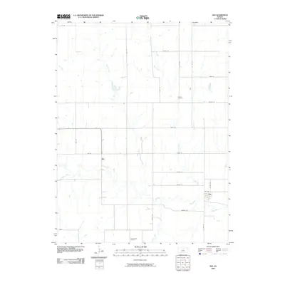
2009 Map of Ada
USGS Topo · Published 2009About this map
The small unincorporated community of Ada sits along the eastern edge of this landscape, its grid of streets such as Ada Ave and N 22nd Rd positioned just north of the winding Salt Creek. To the west, the crossroads of Milo is located near the confluence of East Elkhorn Creek and Salt Creek, representing a quiet agricultural hub in Ottawa County during the early 21st century. The terrain is defined by a dendritic drainage pattern where Second Creek, First Creek, and Cow Creek flow southward to join the larger Salt Creek system. Genealogists will find historical value in the well-marked Baldwin Cemetery and Spring Creek Cemetery, which serve as quiet landmarks among the section-line roads like Quartz Rd and Mohawk Rd that partition this central Kansas prairie.
Find a feature on this map
30 named features on this map. Tap any name to fly to it.
Don’t see what you’re looking for? This feature index may not catch every label — zoom into the map to look around manually.
Map Details
Editions of this 2009 Ada Map
This is the sole edition of this map. No revisions or reprints were ever made.
Other maps of this area

1892 · Minneapolis
USGS Topo · 1:125,000

1894 · Beloit
USGS Topo · 1:125,000

1952 · Glasco SW
USGS Topo · 1:24,000

1952 · Glasco
USGS Topo · 1:24,000

1955 · Manhattan
USGS Topo · 1:250,000

1955 · Beloit
USGS Topo · 1:250,000

1956 · Manhattan
USGS Topo · 1:250,000

1957 · Manhattan
USGS Topo · 1:250,000

1959 · Beloit
USGS Topo · 1:250,000

1961 · Tescott NE
USGS Topo · 1:24,000