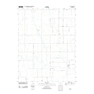
2012 Map of Ada
USGS Topo · Published 2012About this map
Ada sits at the intersection of White St and N 30th Rd, serving as a focal point for this rural Ottawa County landscape. The area is defined by the winding course of Salt Creek and its various tributaries, including Cow Creek and First Creek, which create a complex drainage pattern across the agricultural grid. To the west, the small settlement of Milo stands near the banks of Salt Creek, illustrating the dispersed nature of early Kansas communities. For those researching local history, the map documents several important burial sites that anchor the rural landscape: the Bohemian National Cemetery in the northeast, the Baldwin Cemetery near Quartz Rd, and the Spring Creek Cemetery to the south. These landmarks, along with the section-line road network, reveal the enduring structure of the region's homesteading past.
Find a feature on this map
37 named features on this map. Tap any name to fly to it.
Don’t see what you’re looking for? This feature index may not catch every label — zoom into the map to look around manually.
Map Details
Editions of this 2012 Ada Map
This is the sole edition of this map. No revisions or reprints were ever made.
Other maps of this area

1892 · Minneapolis
USGS Topo · 1:125,000

1894 · Beloit
USGS Topo · 1:125,000

1952 · Glasco SW
USGS Topo · 1:24,000

1952 · Glasco
USGS Topo · 1:24,000

1955 · Manhattan
USGS Topo · 1:250,000

1955 · Beloit
USGS Topo · 1:250,000

1956 · Manhattan
USGS Topo · 1:250,000

1957 · Manhattan
USGS Topo · 1:250,000

1959 · Beloit
USGS Topo · 1:250,000

1961 · Tescott NE
USGS Topo · 1:24,000