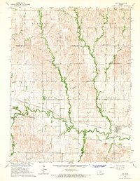
1964 Map of Ada
USGS Topo · Published 1966About this map
The Atchison Topeka and Santa Fe railroad corridor anchors the landscape of this mid-1960s Kansas survey, following the valley floor of Salt Creek. The small settlement of Ada stands at the eastern edge of the quadrangle, complete with Luke Park, while the smaller community of Milo sits further west along the rail line. The terrain is defined by a dense network of meandering waterways, including Second Creek, First Creek, and Cow Creek, which carve through the high plains of north-central Kansas.
Find a feature on this map
27 named features on this map. Tap any name to fly to it.
Don’t see what you’re looking for? This feature index may not catch every label — zoom into the map to look around manually.
Map Details
Editions of this 1964 Ada Map
This is the sole edition of this map. No revisions or reprints were ever made.
Other maps of this area

1892 · Minneapolis
USGS Topo · 1:125,000

1894 · Beloit
USGS Topo · 1:125,000

1952 · Glasco SW
USGS Topo · 1:24,000

1952 · Glasco
USGS Topo · 1:24,000

1955 · Manhattan
USGS Topo · 1:250,000

1955 · Beloit
USGS Topo · 1:250,000

1956 · Manhattan
USGS Topo · 1:250,000

1957 · Manhattan
USGS Topo · 1:250,000

1959 · Beloit
USGS Topo · 1:250,000

1961 · Tescott NE
USGS Topo · 1:24,000