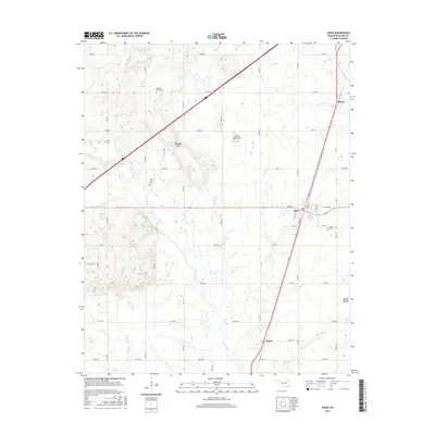
2016 Map of Adair
USGS Topo · Published 2016About this map
Adair serves as the central hub of this 2016 survey, where the local street grid including Main St and Adair St meets the north-south transport corridor. The landscape is defined by the winding course of Pryor Creek and its tributaries like Bitter Cr and Osage Cr, which carve through the Oklahoma terrain. For those researching local families, several established burial grounds are documented, including Adair Cem, West Adair Cem, Rider Cem, and Pleasant Hope Cem. The topography is marked by distinctive named rises and depressions, most notably Jesse James Hill and the nearby Whiskey Gap, along with Squaw Hollow to the east. These landmarks, alongside smaller settlements like Patton and Green, provide a clear picture of the modern rural layout in Mayes County.
Find a feature on this map
55 named features on this map. Tap any name to fly to it.
Don’t see what you’re looking for? This feature index may not catch every label — zoom into the map to look around manually.
Map Details
Editions of this 2016 Adair Map
This is the sole edition of this map. No revisions or reprints were ever made.
Other maps of this area

1896 · Pryor
USGS Topo · 1:125,000

1901 · Vinita
USGS Topo · 1:125,000

1901 · Pryor
USGS Topo · 1:125,000

1913 · Vinita
USGS Topo · 1:125,000

1954 · Tulsa
USGS Topo · 1:250,000

1958 · Tulsa
USGS Topo · 1:250,000

1963 · Tulsa
USGS Topo · 1:250,000

1969 · Adair
USGS Topo · 1:24,000
1970 · Bushyhead
USGS Topo · 1:24,000

1970 · Chelsea
USGS Topo · 1:24,000