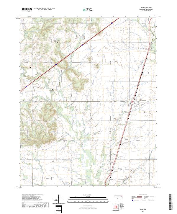
2023 Map of Adair
USGS Topo · Published 2023About this map
Adair sits at the heart of this landscape, where the local road network and rail lines converge near the eastern edge of the survey area. The terrain is defined by a series of north-south drainage systems, most notably Pryor Creek and its many tributaries like Bitter Creek and Little Pryor Creek. To the west, the topography becomes more varied, rising into landmarks with colorful local designations such as Whiskey Gap and Jesse James Hill.
Find a feature on this map
62 named features on this map. Tap any name to fly to it.
Don’t see what you’re looking for? This feature index may not catch every label — zoom into the map to look around manually.
Map Details
Editions of this 2023 Adair Map
This is the sole edition of this map. No revisions or reprints were ever made.
Other maps of this area

1896 · Pryor
USGS Topo · 1:125,000

1901 · Vinita
USGS Topo · 1:125,000

1901 · Pryor
USGS Topo · 1:125,000

1913 · Vinita
USGS Topo · 1:125,000

1954 · Tulsa
USGS Topo · 1:250,000

1958 · Tulsa
USGS Topo · 1:250,000

1963 · Tulsa
USGS Topo · 1:250,000

1969 · Adair
USGS Topo · 1:24,000
1970 · Bushyhead
USGS Topo · 1:24,000

1970 · Chelsea
USGS Topo · 1:24,000